
Technology has changed the face of resource management and one tool in particular has gained popularity as a resource for visualizing diverse landscapes. Drones, also known as unmanned aerial vehicles (UAVs), are an incredible tool to capture both large and fine scale aerial imagery of anything from tracts of wilderness to large infrastructure projects.
Drones can be programmed to fly autonomously to capture images or video of a particular point of interest. By creating linear or polygonal flight plans, the drone captures a continuous series of images with set points of overlap. Each image taken is georeferenced, meaning that it can be overlaid with lower resolution images (like those from Google Earth), or imported into GIS programs for desktop analysis. Additionally, these sequential images can be stitched together to create large, high-resolution orthomosaic maps that can cover kilometers of ground distance. These maps can be accessed online or exported in a variety of file formats for use in spatial analysis (desktop analysis), to measure distances or area, or simply as high-quality imagery of a particular site.
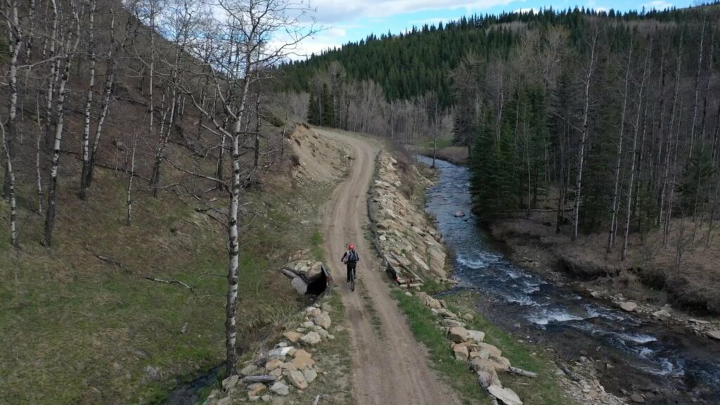
Recently, AJM put our drone to use to create large scale orthomosaic maps for an aquatic resource management project. We were tasked with mapping a river and its tributaries through a public land use zone. The client’s focus was to identify impacts of off-highway vehicle (OHV) crossings on the watercourse and identify features that relate to fish habitat. Overall, the river and its tributaries spanned over 15 linear kilometers of challenging terrain. Inspecting the entire watercourse would have taken extensive, and expensive, man-hours to perform a full habitat assessment. However, using the AJM drone, our team was able to cover the river and tributaries capturing over 5,500 images over the course of 2 days. These images were then run through a program to produce high-resolution (3cm/pixel) maps of the river and its tributaries. The resulting maps allowed the AJM team to fulfill the client’s needs and provide detailed pre-restoration overview of the entire project area. The AJM field crew also requested they use mountain bikes instead of OHV’s to minimize their impact during field assessments…not a bad day in the office!
At AJM we strive to provide expert insight and cost-effective consulting and technology solutions. Our drone program is a marriage of these values and we look forward to being your eye in the sky.
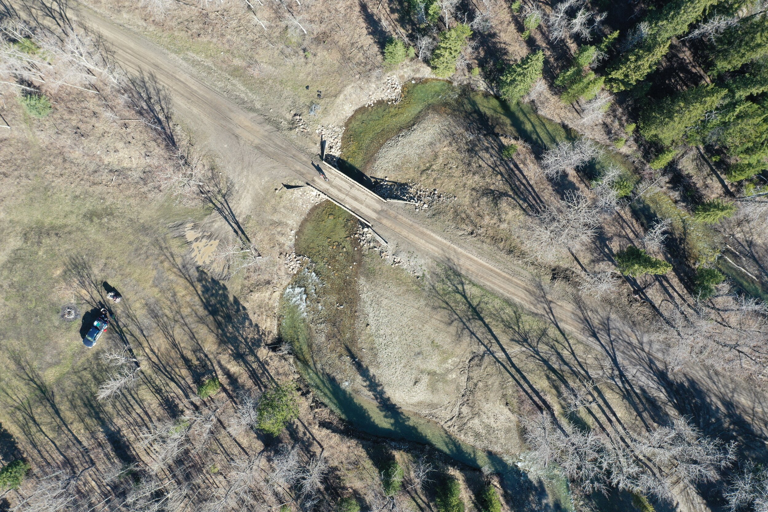
This is raw imagery taken using AJM’s drone. The image is of a bridge crossing on Trout Creek. Compare this image with that of the one below taken from Google Earth and notice the incredible difference in quality.
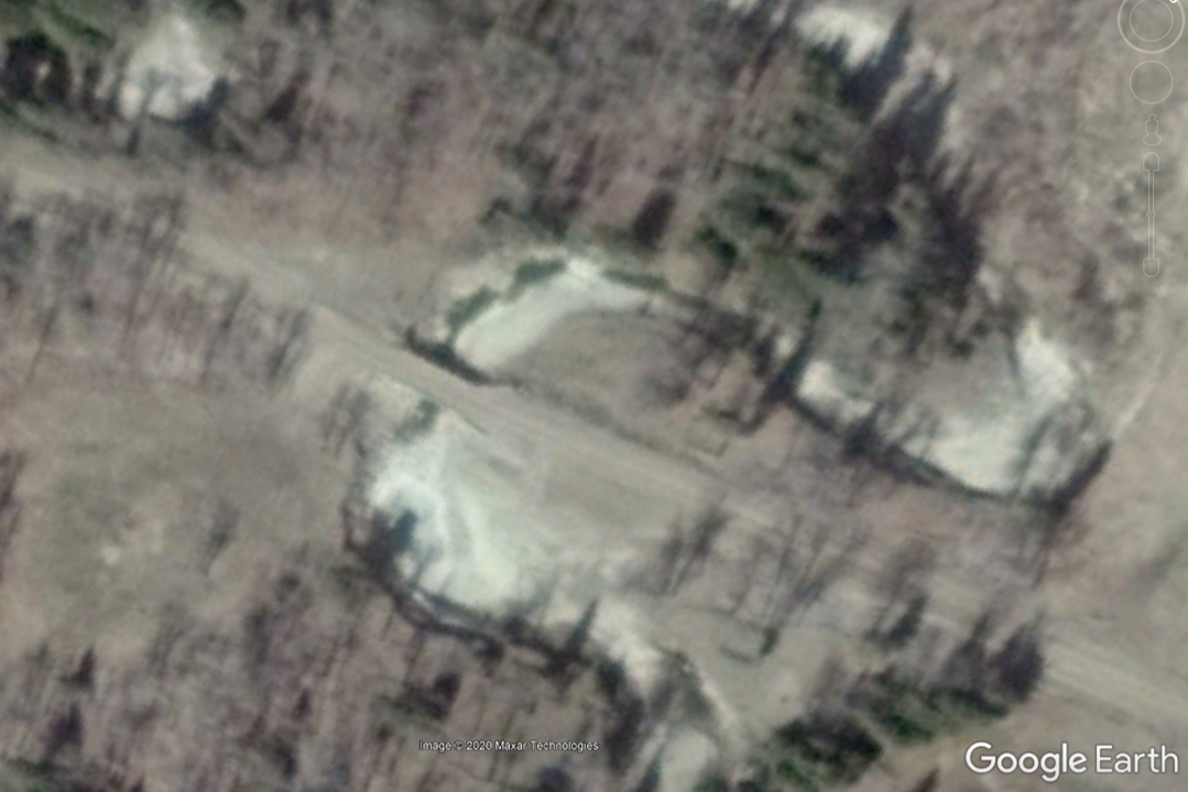
This is the Google Earth image of the same bridge crossing on Trout Creek.
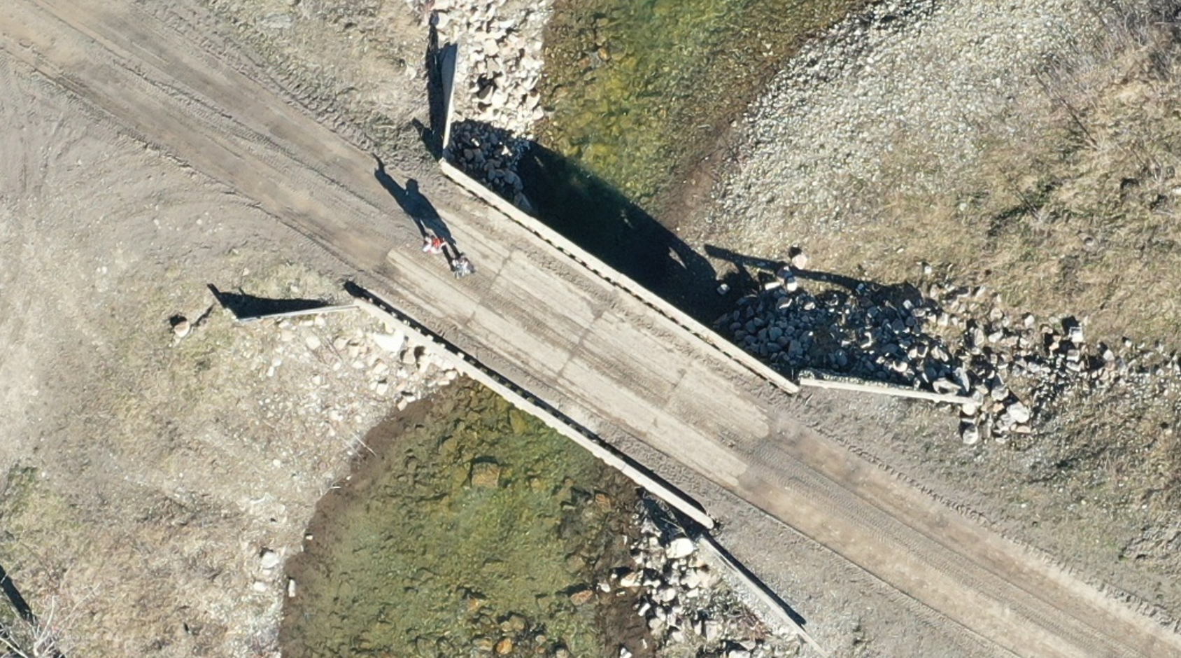
A zoomed-in AJM drone image of the same bridge crossing showing the level of detail that can be captured using AJM’s eye in the sky!